


DetoxViva RoadReady Atlas — 2027 Road Atlas & National Park Guide
DetoxViva RoadReady Atlas — 2027 Road Atlas & National Park Guide
Works with zero signal and zero battery — always reliable
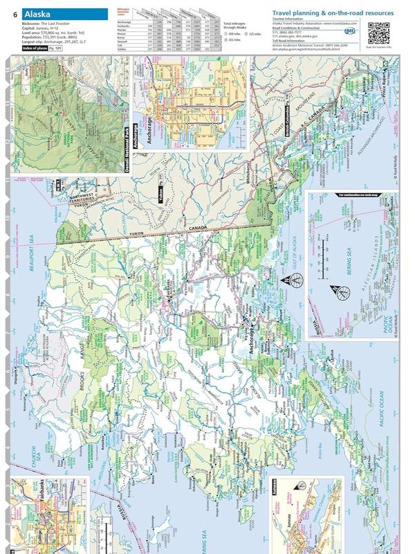
Covers all 50 states, Canada, Mexico + all 63 National Parks
The perfect screen-free activity for kids and a gift worth remembering
Couldn't load pickup availability
DetoxViva RoadReady Atlas — 2027 Road Atlas & National Park Guide
"My cell service died in the middle of nowhere. This atlas saved my whole road trip."


Your phone will fail you. This won't.
You've been there. Middle of nowhere, no signal, GPS spinning, no idea which way to go. In 2026, cell dead zones are still very real — and if you've ever been stranded, you know the panic.
The problem isn't just weak coverage. It's that we've handed 100% of our navigation to a device that needs bars and a battery. The second either disappears, you're stuck.
The DetoxViva RoadReady Atlas gives you the full picture — every road, every state, every national park — printed and ready whether you have signal or not. This is your backup that never lets you down.
Results of DetoxViva RoadReady Atlas
95%
of users said they felt more confident on road trips after keeping an atlas in their car
93%
of parents said it became a go-to screen-free activity their kids actually enjoyed
"My kids were obsessed with tracing routes for hours."
94%
of buyers said it unlocked a planning experience GPS apps can never replicate
"Seeing the whole country laid out — nothing beats it."
Over 10,000+ Happy Customers
You've Got Questions
We've Got Answers!
What is the DetoxViva RoadReady Atlas?
What is the DetoxViva RoadReady Atlas?
It's the 2027 edition road atlas covering all 50 US states, Canada, Mexico, and a complete guide to all 63 US National Parks — printed, spiral-bound, and ready to use anywhere with no signal or battery needed.
How do I use it?
How do I use it?
Keep it in your car, RV, or travel bag. Open it before or during any road trip to plan routes, navigate dead zones, or explore national park details before you arrive.
When will I see the value?
When will I see the value?
The first time your phone loses signal on a road trip, you'll understand immediately. Most buyers say they wish they'd gotten it sooner.
Who is this for?
Who is this for?
Anyone who drives — road trippers, outdoor adventurers, parents, grandparents, RV travelers, or anyone looking for the perfect practical gift for a dad or grandpa who loves to travel.